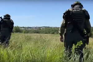

Coordinate Distortion and GPS Signal Jamming
Yes, during air raids or under special security conditions in Ukraine, GNSS coordinates may be altered or deliberately distorted. This is done to hinder the operation of enemy guidance systems. At the same time, the impact on agricultural navigation depends on several factors:
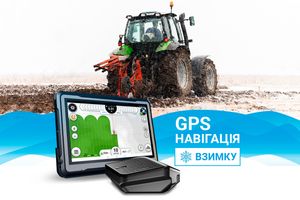
1. How GNSS Works in Smartphones and Agricultural Navigation
- Smartphones: Use civilian GNSS (GPS, GLONASS, Galileo, BeiDou), often in combination with A-GPS (Assisted GPS via the internet or mobile network). Deviations can be significant due to interference, weak signal, or location correction algorithms.
- Agricultural navigation systems: Use the same satellite systems but on a more stable and accurate level.
2. Impact of Signal Jamming or Coordinate Distortion
- If coordinates are deliberately distorted, smartphones may show a location with a large deviation (tens or even hundreds of meters).
- Agricultural navigation without RTK may also have some error, but it’s usually smaller than that of smartphones, as professional GNSS receivers have better antennas and filtering algorithms.
- When signal jamming or shifting occurs, agricultural navigation equipment may temporarily lose accuracy or display incorrect coordinates.
3. Why Do Smartphone Coordinates “Jump” While Agricultural Navigation Is More Stable?
- Smartphones have simpler antennas and weaker filters for blocking interference.
- They may rely on mobile networks (A-GPS), and when those are unavailable, accuracy drops significantly.
- Agricultural GNSS receivers have higher sensitivity, making them less prone to short-term disruptions.
If coordinate distortion occurs, agricultural navigation near major cities and important infrastructure may experience errors during air raids—but these are significantly less than those seen with standard navigation devices.
Protection Against Radio Interference and Signal Jamming
Due to the widespread use of modern electronic warfare technologies to suppress navigation systems, it’s important to use specialized solutions to protect against jamming and signal distortion. This includes systems based on Controlled Reception Pattern Antenna (CRPA) technology, which filters interference and ensures stable GNSS signal reception.
Our GNSS Protection Solutions:
-
TUALCOM 4200 MINI – a compact 4-element CRPA antenna designed for UAVs and other platforms requiring reliable protection against radio interference. Key advantages:
- Reduced impact of jamming and interference.
- High performance in challenging environments.
- Compact design and low power consumption.
-
TUALCOM GPS/GNSS TUALAJ 8200 – an active anti-jamming system that provides:
- Real-time interference filtering and suppression.
- Stable GPS/GNSS signal reception even under aggressive electronic attack.
- Enhanced navigation accuracy for military, agricultural, and unmanned technologies.
🔗 Learn more: TUALCOM GPS/GNSS TUALAJ 8200
Conclusion:
If coordinate distortion occurs, agricultural navigation near major cities and key sites may experience some errors during air raids, but far less than standard navigation devices. To minimize jamming impact and improve GPS/GNSS navigation accuracy, it is recommended to use specialized protection systems such as TUALCOM 4200 MINI and TUALCOM GPS/GNSS TUALAJ 8200.